Kasba Lake, Nunavut. Resupply # 4


For several weeks now since we left Southend,SK, we have finished what has been the hardest part of our trip, as expected.
We said see you later to family and Southend toward the end of June and pushed off north across the large expanse of Reindeer Lake. We had initially planned to travel a westerly route through some bays and channels hidden from the wind, but after talking with locals, the few portages we would need to do were in an unknown state are largely only used in winter with snowmobiles by people from the Lac Brochet area. With newly heavy packs, we decided to play it safe and stick to the main lake and use its many islands as wind breaks. Reindeer Lake is a beautiful lake with many rocky outcrops and thousands of islands. Made the big lake feel very small. It was very cold and clear, offering us some cold evening baths and an abundance of lake trout caught from camp!
As we moved north on the lake, the big rolling hills we saw at its beginning became smaller and the shores less rocky and brushier.
From Reindeer lake, we spent a few, hard days traveling west toward Wollaston Lake through an old trade route linking the two lakes. This route used to be used quite often, but now very few paddlers travel it, along with a few snow machines in the winter. First, we paddled up the Swan River. As we entered the river, we watched a black bear 40 yards away fishing in the rapids that flow into Reindeer Lake. Paid no attention to us, and slipped back into the woods it came from. Going up the Swan was tough going. Very similar to the Sturgeon-Weir, but much faster, deeper water making walking/lining harder. We paddled when we could in deep spots, then resorted to grabbing alders and other overhanging branches on the shore to pull our way up the rapids, often chest deep. It was a long day, but we arrived at Swan Lake in the evening and found a nice camp to stay the night.
The next day, similarly, was a lot of work. We were again going upriver on a much smaller river, the Blondeau. Only about 15-20 feet wide, it had a fast current and the most bends and turns you can find on any river out there. If traveling a kilometer on open lake took us 10 minutes or so, on this river it could take 30 minutes in some places with how the river would turn back on itself so often. It was not too challenging, just a lot of hard paddling, drawing and prying to get the canoe around the inside bends of the river as efficiently as possibly. It got dizzy with how frequently we needed to turn and the close intimacy of the river made navigating hard without being able to see landmarks. Really a beautiful little river though with clear water and largely sandy bottom. Often talked about how it was the perfect river to take a tube down. Just makes you go a little crazy to see how slow your progress is made on it!
Later in the afternoon, we came to where we thought the takeout spot along the river was to a series of portages that cut west to Wollaston. This used to be marked with an old Hudson Bay Post on the rivers bank, but it has since been burnt and gone. We searched for awhile and eventually found an area where others had camped on a high esker ridge with old blaze marks on trees. We followed the blaze’s as best we could, while marking our own trail to the first lake. Rising up over a big hill, it was a decent length portage to this lake. With poor loading and camping on the lake, we decided to do the next small portage and found a poor area to camp on the lake. It had been a very long day, so we made it work.
The next day was a long one. A hard push to Wollaston lake over a series of seven portages. Some of these were shorter and through drier areas with recent burns (which did a good job tearing apart some of our clothes), others were through some of the worst muskeg and swamp imaginable. Appropriately named “Muskeg Portages”. To make it harder, the bugs were out in full force and it was one of the hottest days we had seen, likely upper 80’s. Our food pack didn’t feel any heavier than a personal pack by the end of the day, any weight we carried slowed us down. When you are up to your knees to mid thighs in watery mud with each step, it’s a lot of energy to move your legs a few inches, let alone several kilometers we needed to portage that day. By the end, we were both the most sore and exhausted we had been on the trip. Our legs badly cramping from their over use and our lack of water. As soon as we had reached Wollaston, we found the first rock to set up camp, which turned out to be a good one. We spent the next day resting.
We again pushed north across Wollaston Lake, with a few cloudy and gloomy days. Wollaston Lake is an interesting lake in our route as its waters feed two watersheds. From there, it flows west and north through the Fond Du Lac River and on down to eventually the Mackenzie River and the Arctic Ocean. On the north end, it flows back south to Reindeer Lake and into the Churchill River and into Hudson Bay.
We passed the last community of our trip of Wollaston Lake and due to some of our trip paperwork needing some attention, we stopped briefly in the afternoon to talk with the RCMP in town before finding camp. The whole town and RCMP were incredibly friendly! We wished we could have spent some more time here.
The next day we found ourselves entering the Cochrane River, which flows out of Wollaston into Reindeer lake. We were excited to be going down stream again. This river is big though and is largely a long lake with a few narrow sections that separate the lakes by a few rapids. We did a few portages around big sets and shot down a few small ones. Where the river cut south to Reindeer Lake, we again looked for a series of portages that would take us north. This is the “old north trail” that was once heavily used to connect the trade and goods of the Arctic and sub-Arctic/treeline areas. It’s a long series of portages and lakes known as the “ little lakes” or “esker lakes”. Thought by many paddlers to be one of the prettiest areas of the north, it sure was scenic!
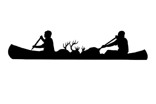
The little lakes largely follow a northeasterly esker (sandy hills from the rivers of the last glacial period). This area had lots of sandy ridges and hills with spruce forests that were spaced widely and had little vegetation in the understory. A well maintained park is the best way to describe it. The portages were usually up and over these sandy hills and eskers and since caribou use the area in winter, there were many trails and some antlers found along the way. One notable lake on this section, Blue Lake, has the portage dropping into a bowl like area. This bay of the lake is an emerald blue with some of the clearest water we’ve seen! With the high rising hills, it felt as though we were on some mountain lake in Banff. Very scenic! We decided to camp there for the night on its banks.
The next day, we finished the little lakes and entered the Thlewiaza River, which flows east to Hudson Bay. Again, nice the be going down stream. We paddled through a few big lakes on it, one of which used to have a Hudson Bay Post on it. Like the other, it has long been gone and burnt, but we were able to find lots of cans, bones, timbers, and other miscellaneous items around the grassy opening where it once stood over lunch. The Thlewiaza had a better current than the Cochrane and was much smaller. We quickly arrived at Kasmere Falls, a long series of rapids requiring a long portage around the thundering falls. We did the portage again on a hot and buggy day, and continued down river, shooting a few swifts before entering Kasmere Lake, a large lake on the river.
From here, we jumped off the river and headed upriver, again. This time out of the lakes north arm and onto the Little Partridge River. This river and the area between Kasmere Lake and Kasba is rarely paddled from our understanding and we went into it knowing it would be a challenge, which it lived up to be.
The Little Partridge River had a beautiful beginning out of Kasmere Lake with lots of sandy hills and nice scenery. We paddled, or rather dragged our way up this river for two big, long days. We have received a lot of rain throughout our trip and it helped us a lot on this river. We could tell the water was a bit higher than usually as we went up it, which offered us some deeper channels and passages that otherwise wouldn’t be there. God help any paddlers who find themselves paddling this river in low water.
For the entirety of the first day, we get out to wade or line up a rapids, then get in to paddle for about 10-15 mins, then going back to wading/lining and repeating this all day long. It is more a series of ponds connected by pinches of rapids that offered no portages. It was either wade through it, or find the best side to portage around. The wading on this river was the hardest we’ve had. The water was very clear, but the bottom was a dark black and the slime that grew on the rocks were also black. You could never tell where the rocks were or where the deep holes were. The footing was never sure and we both had to cling to the canoe for any stability as we pushed up it.
The middle section of the river is pretty featureless and the forest is thicker and grows closer to the banks. The second day, it was again the same routine, walk on the slippery, unstable rocks you couldn’t see, then paddle a bit, to do it all over again, all day long. Exhausted, we opted to have a big push at the end of this day to Roosevelt Lake toward the rivers headwaters. We gave ourselves another rest day here and glad we did and the whole next day it rained hard and the temperature dropped. The upper Little Partidge and the area around Roosevelt Lake is very scenic with large hills all around, one in particular, Roosevelt Hill, was named by famous northern traveler Tyrell, who’s partner that was with him on their journey through the area named the hill after US President Theodore Roosevelt, who he had been climbing with on a prior trip.
The day after our rest day, the rain continued and so did the cold. Close to Kasba Lake, we decided to push on through the remaining string of portages through little lakes and ponds over to Kasba Lake. Again, one of the hardest days we’ve seen. Mentally, it was draining to stay motivated with a hard rain and very cold temperatures. The “portages” between these lakes did not exist because of how infrequently this area is traveled. There was no use for us to even look for portages, we just looked for the best places to walk and went through it to the next lake. All these lakes were again very small and more pond like that we spent much more time portaging than paddling. Some of these portages surpassed our expectations and were pretty short or through open source forest with solid ground. But most were through swamp or through dense alder/willow thickets. Combined with the steady rain and walking through the wet forest, we were as soaked as you can get and for us to stop moving would make us dangerously cold in that temperature. With no good camping areas, we continued to push on.
The small creek that appeared on our map between the ponds gradually picked up water and speed, allowing us to do more wading in its frigid waters down small rapids, then portage where necessary. It was a nice little river with sandy bottom and good current to it to help us along. Lots of “strainers” or logs laying across its narrow path and small sets of rapids took up time. We had a few big portages over steep hills towards its end around falls. We also saw a few beavers on this river, which seemed odd as we hadn’t seen them for several days and being so close to the tundra, this must be close to their northern extent! Eventually, with ourselves and our gear a bit beat up, we flowed into Kasba Lake late in the evening and set up camp on its shores. Quickly changing into anything dry or warm we had to shake the cold.
The next day was equally as nasty with dreary wet and cold weather. We opted to rest from the day before we headed off across Kasba Lake on a very opposite hot and sunny day. The whole lake has extremely high water with the trees and bushes along the shores submerged in water. It has been a rollercoaster of water levels as we have gone throughout our trip. Some people saying water levels are really low, others high, and everywhere in between.
We saw tons of trout surfacing throughout the day as we paddled ancross Kasba and even a moose on a small island in the middle of it. We reached Kasba Lake Lodge around 5:30pm and as we pulled up, our blue barrels of food were waiting for us at the end of the dock. Quickly, boats from across the lake and their float plane from fly out trips were arriving back at the lodge. We were taken away by the welcome and help we received from the folks at the lodge. A great place! We were able to have some great conversations with two other paddlers, Brad and Patty Hager from Maine who were on their way to the Nueltin Lake area and flying out from the lodge. Wonderful to talk canoeing, rivers, and the north with so many great people while spending time here.
With the last of our gear packed and our packs heavy once again, we will be headed down some of the Crown Jewels of northern paddling. First onto the Kazan, then Dubawnt, Thelon, and the Meadowbank River to the Back River into our final destination on Chantrey Inlet. Hard to believe this is our last resupply before the end. We have seen and done some amazing things, with many more yet to come. More updates to come from the end in Gjoa Haven, Nunavut! Thanks for following along.